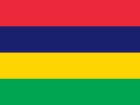
The Republic of Mauritius joined the Southern African Development Community (SADC) in 1995. Mauritius attended the 15th SADC Summit for the first time in Midrand, South Africa, on 28 August 1995, becoming the regional bloc’s 12th Member State and the first island nation to join SADC, following the signing of instruments of accession by the country’s then Prime Minister Navinchandra Ramgoolam.
Mauritius is situated in the south west Indian Ocean, approximately 2,400 km from the south east coast of Africa, located just to the north of the Tropic of Capricorn. The island is only 67 km in length and 46 km at its widest point, with a total land area of 2,040 km², owing its origins to submarine volcanic activity.
English is the official language, while French and Creole are widely spoken. Port Louis is the capital of Mauritius and the other main centre is Rodrigues, which is home to people from African, European and Asian descent. Mauritius gained independence from Britain on 12 March 1968. The President is the Head of State and Commander-in-Chief. Full executive power rests with the Prime Minister, who is the head of government. Mauritius is a parliamentary democracy, with government by coalition as a standard feature of Mauritian politics and elections are held every five years.M
Please refer to the latest SADC Statistics Yearbook

